
In April we’re going to Reno. I’ve read Roughing It, and years and years ago I read The Godfather and saw the movies. I watched a lot of Bonanza as a child, and once, coming back to Houston from somewhere, we had a layover in the Vegas airport. Kris played the slots and I didn’t. I know most of the words to Folsom Prison Blues, and could probably still play it on the guitar. In college I read Fear and Loathing in Las Vegas. I don’t think that’s the reason I went to law school, but who knows? Everybody needs a lawyer.
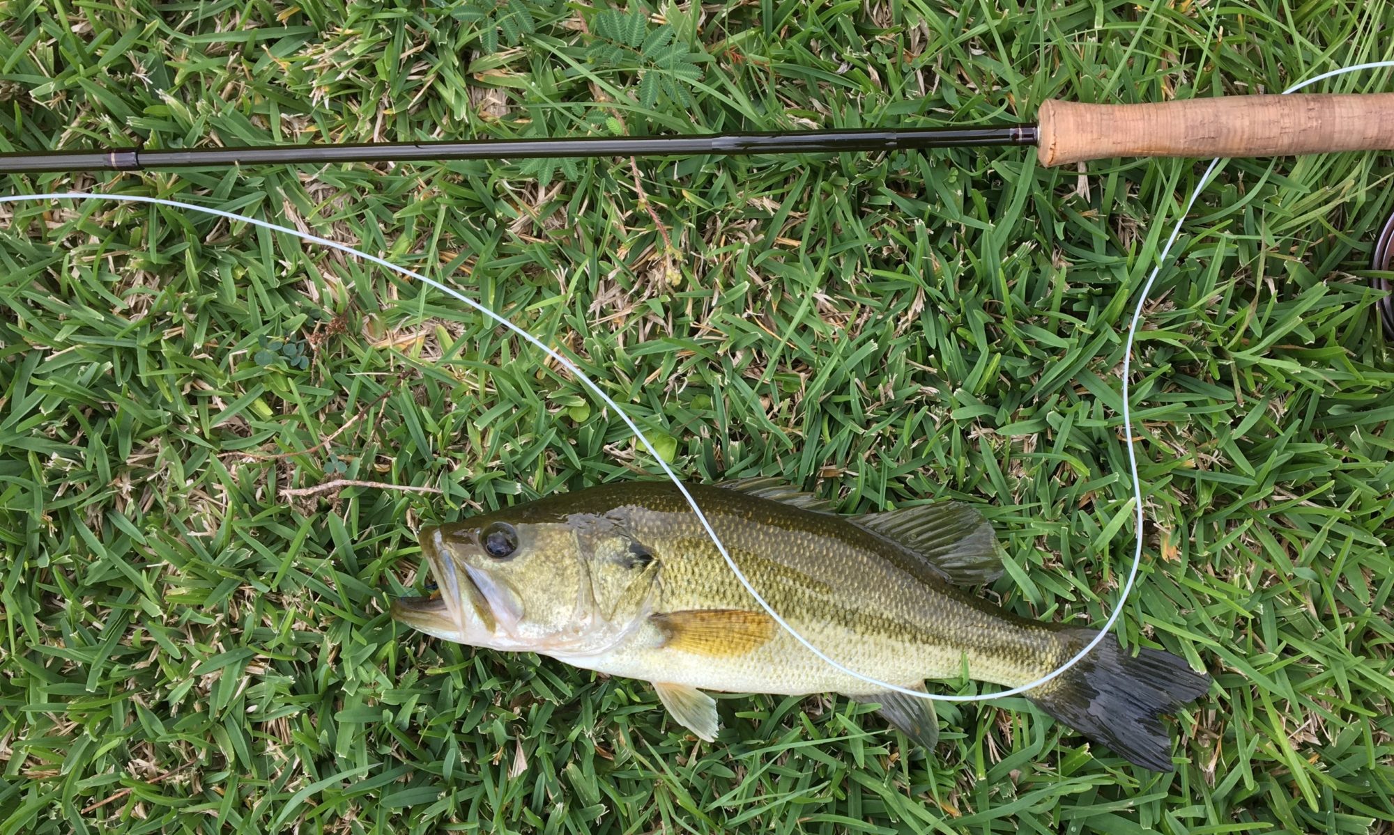
We’re leaving Thursday April 11, and coming back on the next Sunday, fishing Friday and Saturday. We’re fishing one day on Pyramid Lake and one day on the Truckee River. Our guide, Casey Gipson, says that April is a great time to fish near Reno. The average high for April is 64°, the average low is 35°, so it’s probably a great time because nobody fishes when the temperatures are near-arctic. I get hypothermia just thinking about 64°. The good news is that Reno is not only west of the 98th meridian, it’s in the rain shadow of the Sierra Nevada for a stunning 7.48 inches of rain per year. Putting that into my own peculiar perspective, my hometown (which was also west of the 98th and certainly dry), averages 28 inches per year. Houston averages about 50.
Reno averages two days of rain in April, and if you were a betting man and wanted to lay down money in Reno, betting that it will rain April 12 and 13 would be pretty safe.

I’ve considered flying into Las Vegas and then driving to Reno. Flying into Reno we’re missing Las Vegas. Everybody knows Las Vegas. Sin city! Wayne Newton! What happens in Vegas! There is gambling and booze and ladies who dance naked and Elton John** at the Stardust or the Carousel or some such! I don’t know, the naked ladies sound sort of interesting, but it’s a 440-mile drive northwest up the border to Reno. While that’s appealing, we’d have to go a day early to see anything of Vegas, and I don’t really like Elton John. I bet we could rent a Cadillac convertible for the drive though.

Reno is located a bit more than halfway up the Nevada border, on the cusp of the Great Basin, just east of the Sierra Nevada Mountains, at 4,400 feet above sea level. Boundary Peak, at 13,147 feet, is the highest point in Nevada and is a few hours south of Reno. The lowest point, where the Southern border meets the Colorado River, is 481 feet. The elevation at Las Vegas is 2,030 feet. Overall Nevada is our highest state, with an average elevation of 5,500 feet. I thought sure our highest state would be Colorado. Nevada, notwithstanding legalizing everything but mafia murder (which is only tolerated), refused to legalize marijuana in 2002 and didn’t vote for legalization until 2016.
This elevation stuff is important, not because we’ll be going up and down but because it’s what characterizes much of North America from eastern California to Colorado, and from southern Idaho into the highlands of northern Mexico: it’s the Basin and Range Province. This is of the highest interest to geologists and John McPhee and maybe not so much to many of the rest of us, but it is at least a bit interesting.
A big area of the Western United States is an alternating series of mountain ranges interspersed by relatively low elevation plains or basins, running more or less parallel like geologic corduroy. When you start reading about it, you get all sorts of geologic jargon that dances in front of your eyes, tectonic plates and crusts and endorheic watersheds, like an Easter sermon in Latin, but the general drift of it is this: There was some stretching of the earth’s crust. The stretching caused some issues. Some crust was lifted up in the glory of the Lord while some collapsed into perdition and sin! Hallelujah!
Maybe corduroy makes more sense. Here’s a description from the U.S. Geological Survey (the internal links are theirs):
Within the Basin and Range Province, the Earth’s crust (and upper mantle) has been stretched up to 100% of its original width. The entire region has been subjected to extension that thinned and cracked the crust as it was pulled apart, creating large faults. Along these roughly north-south-trending faults mountains were uplifted and valleys down-dropped, producing the distinctive alternating pattern of linear mountain ranges and valleys of the Basin and Range province.
See what I mean? Maybe it’s ancient Greek, not Latin. How do they figure the crust was stretched, and what was it stretched from? I think I’ll go back to corduroy.

On the western side of Nevada and the eastern side of California (where the watershed divides was supposed to define the border) is the Sierra Nevada. If you’re facing north and reading from left to right that’s the first range. If you drove the thousand or so miles from Denver to Sacramento you could take great comfort in knowing that not only were you covering a good bit of ground, you’re also covering a goodly number of radical uplifts and down-drops, all lined up in a row. Ok, a squiggly kind of a row.
The United States colonized in a weird way. When Mexico generously gifted us most of the Southwest after the Mexican American War, colonization leap-frogged. We settled the East and the South to about the 100th meridian, then we settled California and Oregon. We pretty much skipped what came between: The Great American Desert. The big exception was the Mormons in Utah, who also tried to settle Colorado and Nevada. In the 1840s there was also exploration in Arizona by fur trading companies and government explorers like John C. Frémont. All of them generally failed to find a path through Nevada to California, even when they looked. The Nevada expeditions attempted to find a river course to follow through the Sierras, but they couldn’t. This may sound heretical to fly fishers, but No Rivers Run Through It.
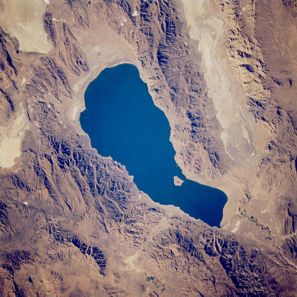
What confused them was a trick of geology. The Great Basin, which covers most of Nevada, covers the same area as much of the Basin and Range Province, but the Great Basin isn’t describing the same thing. Instead it is an endorheic watershed: The water–whatever water comes from 9.63 inches annual rainfall statewide–comes flowing out of the hills and into the valleys and then likely as not peters out in the desert. This is a dry place, and there’s no spare water to share with California. The Truckee runs from Lake Tahoe to Pyramid Lake and that’s it. The Great Basin is the third largest endorheic watershed in the world, after the Chad Basin in Africa and the Caspian Sea at the cusp of Europe and Asia. Endorheic basins don’t have to be dry, ergo the Caspian, but the western desert basin pretty much defines dry. It includes the Great Salt Lake, Bonneville Salt Flats, Death Valley, Lake Tahoe, and Pyramid Lake. The Great Basin is a place water goes to not go any further.

John C. Frémont, noted explorer, Presidential candidate, Governor of Arizona, and civil war general of dubious accomplishment, discovered Pyramid Lake and the Salmon Trout River and named them. He named Pyramid Lake for the rock formation that looks about as much like a pyramid as any other mildly pointed lump of rock, but there you are. He named the Salmon Trout River for the large trout, but then later the name got changed to honor the Paiute chief, Truckee, for his aid to white folk. I’m not sure what the Paiutes got out of that bargain, other than more white folk, but Pyramid Lake is owned and managed by the Pyramid Lake Paiute. Apparently one of Chief Truckee’s worst confrontations was with the Donner Party, which burnt a Paiute food store. I suppose the Donner party figured that anybody could survive a winter with limited food supplies if they just put their mind to it.
**Kris notes that she likes Elton John, and that there is no reason for me to denigrate him. All I can say is that after Madman Across the Water, Elton John was a great personal disappointment to me.