
The 1920s begin modern times. We used electric power for lights and for new gadgets like refrigerators and Hoover vacuum cleaners. There were cars on the streets, moving pictures in the cinemas, jazz on the radio, and telephones in the home. There were airplanes in the sky. Information and people moved in new ways. 1920 looked a lot more like 2020 than it looked like 1820, or even 1890.

You can’t have electricity without copper, lots of copper. Montana had some gold, some silver–oro y plata is the state motto–and when the world began to turn on the lights, Montana brought us Anaconda Copper of Butte, Montana. Anaconda mined and smelted the copper for our copper wire, and we turned on the lights. By the 1920s, Anaconda had eaten up the other copper companies in Montana, and Anaconda Copper was not only the largest mining company in Montana, but one of the largest in the world.
Miners brought with them from Wales and Italy and Germany not only mining skills, but a history of labor organizing and unrest. Cowboys didn’t organize. Shepherds didn’t organize. Farmers did organize briefly under the Populist movement, but the Democrats coopted prairie populism with Free Silver.1 By 1900 Montana miners were unionized, and the unions were strong.
In Butte in 1914 unions in Montana began a swift decline, partly because Anacaonda ate up its competition–the union had a lot less power negotiating with a single powerful employer instead of several divided employers–and partly because of the miners’ own damned fault. The Western Federation of Miners (the “WFM”) had split from the Industrial Workers of the World (the “IWW”, the Wobblies). Insurgent miners formed the Butte Mine Workers Union as a counter to the WFM, which they believed to be in Anaconda’s pocket. While not formally affiliated, most of the leaders of the Butte Mine Workers Union were Wobblies. Anaconda Copper was pitted against the miners, who were pitted both against Anaconda and against each other.
There were gunfights in the streets of Butte. The WFM union hall was dynamited, an Anaconda Copper office was dynamited, and the governor declared martial law. By the end of the clash, the power of Butte miners’ unions was broken, and Butte, which had been a WFM shop, had become an open shop.

It wasn’t a soft landing. In 1917, an IWW organizer, Frank Little, was lynched, at least in part because of the anti-war stance of the Wobblies. In August 1920, the Wobblies and the Metal Mine Workers called for a general strike for higher wages and an 8-hour day. The strikers shut down all of Butte’s mines. Anaconda mine guards opened fire on strikers and shot 16, killing one.2 Federal troops were brought in, union officials were arrested, and the strike fizzled. It was the last major labor conflict in Butte until 1934, when the miners reorganized under New Deal protections.

Along with the end of the union conflicts, other things changed in Montana as well. In 1918 Montanans voted for statewide prohibition, two years before national prohibition. Legal operations of Butte’s red-light district, Venus Alley, were shut down–during the teens there had been as many as 1000 prostitutes licensed by Butte. Hard-rock mining is still a significant sector of Montana’s economy.3 At least three new copper mines are currently proposed, though likely Venus Alley is gone for good.
The last active mine near Butte closed in 1980. In 1982 the last madam of the Dumas Brothel, the longest operating brothel in the US, was convicted of tax evasion, and the Dumas, the last remnant of Venus Alley, closed. The EPA designated the mining area surrounding Butte as a Superfund site, the nation’s largest. The Dumas reportedly was at closing listed in the National Register of Historic Places, though it isn’t now.
Geography and Population
Montana is the fourth largest state by area, after Alaska, Texas, and California, with 147,040 square miles. Its 2024 estimated population was 1,137,233, increased by more than 14% from it’s 2010 population. Montana is growing, probably faster than its residents really want.
It’s still not very big. Its population is slightly smaller than Dallas, and slightly larger than Fort Worth. Puerto Rico has more than 2 million more people, but two fewer senators. Montana is the 43rd largest state by population, smaller than Maine but larger than Rhode Island.
Anglos make up 84.5% of Montana’s population, Blacks alone are 0.5%, Native Americans 6.2%, Asian .8%, Hispanic 4.2%, and two or more races 6.6%.

Montana has a population of 7.73 people per square mile, compared to 1,259 per square mile in New Jersey. Only one city, Billings, has a population greater than 100,000. Three other cities, Missoula, Great Falls, and Bozeman, have populations over 50,000. The towns (and the largest population concentration) spread north-south along the west of the state, along the front range of the Rockies. If you check the maps below, population concentrations pretty much correspond to the western edge of the Rocky Mountains, the the major trout fisheries, and the counties carried by Kamala Harris. The oddest exception for voting in Montana is in Glacier County, population 13,778, where Glacier National Park is located. Park employees and hangers on presumably vote the interest of the Park, or at least their own interest, and Harris carried Glacier County.4
Montana is one of the eight Rocky Mountain states.5 Like New Mexico, Colorado, and Wyoming, about 60% of Montana, the area east of the Continental Divide, is prairie, part of the Great Plains. The principal mountain ranges are in Western Montana, along the Idaho border. There are more than 100 named mountain ranges in Montana, so Montana is probably a pretty good name for the state.

Since the last glaciation, most of Montana’s rivers flow into the Missouri, which in turn flows to the Mississippi and then the Gulf of Mexico. Before the last glaciers, rivers in Montana flowed to the Red River of the North and on to Hudson Bay. Times change.
Montana rivers are among the best-known trout rivers in the world. The Yellowstone begins at Yellowstone Lake in the Park, and flows Northwest into South Dakota to join the Missouri. The Big Hole, Jefferson, Madison, and Gallatin are northwest of the Park, and that’s where we’re going. The Missouri begins where the Jefferson meets the Madison, and we’ll fish both the Jefferson and the Madison.
There’s also the Bighorn and Powder, the Bitterroot, Clark Fork, and Blackfoot, and somewhere in there is the Smith. The Flathead, which I’ve spent a pleasant day fishing, is generally considered in fly-fishing literature to be a second-rate fishery. Anywhere else it would be a destination.
There was good reason to leave Montana until last. For fly fishing in the US, only Alaska has a reputation to match. It’s too bad our planning got knocked out of whack by that whole New Jersey thing.6

Trout
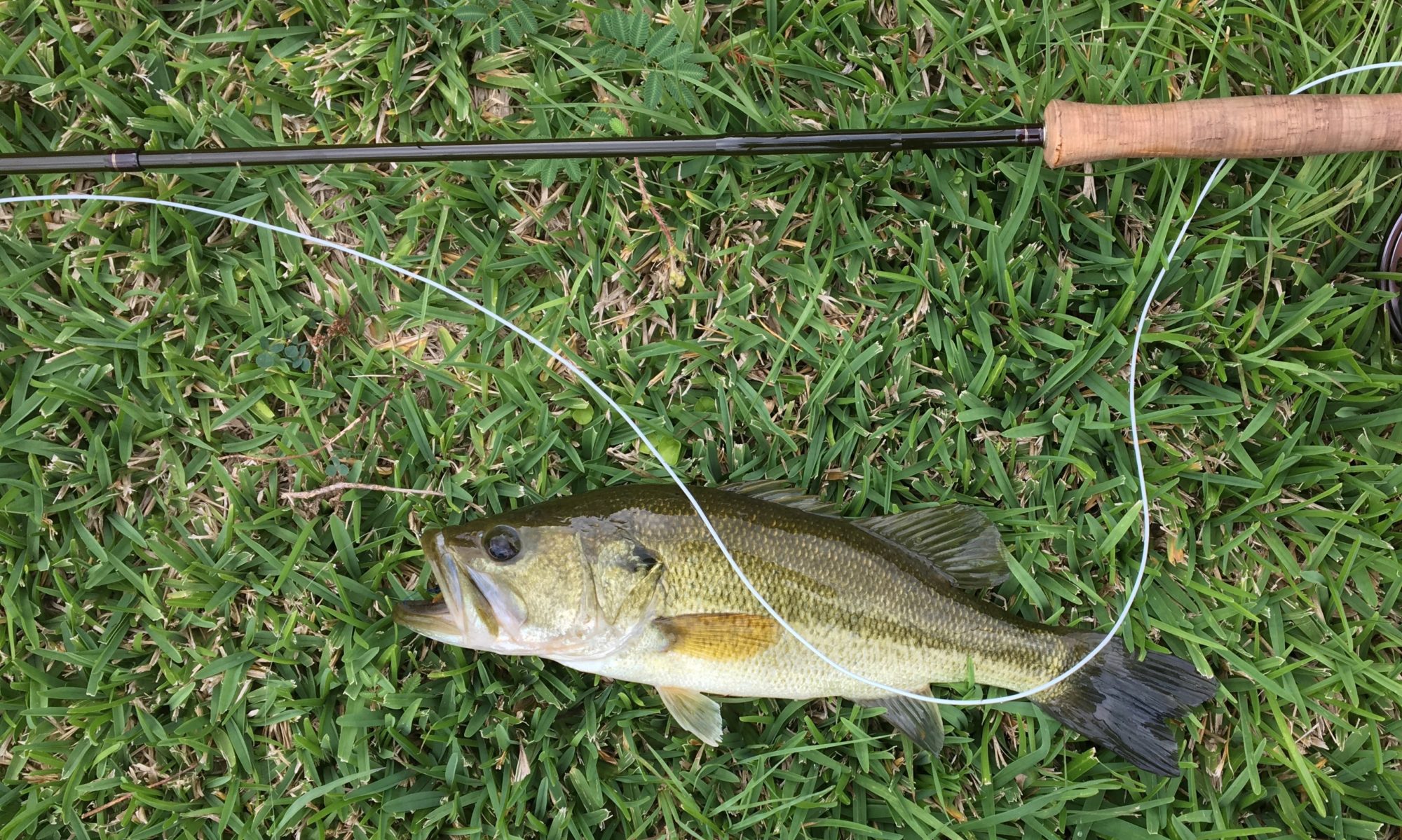
The online Montana state field guide to native and non-native trout provides a good identification photo of native and non-native Montana trout, the trout’s current range, their native range (which is often very different), and whether the fish’s survival in Montana is threatened. Arctic grayling, bull trout, Rocky Mountain cutthroats, westslope cutthroats, and lake trout are all native, and are all species of concern in their native Montana habitat. Westslope cutthroats are the most widely distributed native trout in the Northwest, from the West Slope of Montana across the Rockies into Idaho, Oregon, Washington, and British Columbia, all the way to the Pacific.
Brown trout and brook trout are non-native, though both are widely distributed throughout Montana. Rainbow trout (including Columbia River redband trout), are native to a tiny section of far northwest Montana, in the Kootenay drainage. Instead of draining east to the Gulf, the Kootenay drains west to the Pacific, so rainbows native to the Pacific Coast make it to the Kootenay. In addition to the Kootenay rainbows, rainbow trout have been introduced throughout the state.
The state of Montana has led other states to end hatchery stocking programs where there are healthy populations of wild fish, so even where fish caught are non-native browns or rainbows, they are almost certainly wild.
Because it is such an important destination fishery, when something does happen to Montana fish, it makes national news among fly fishers, even people like me who rarely go to Montana. There was the introduction of whirling disease back in the 90s, and in the past years there are reported declines of large trout in the Madison River system. Crowding on Montana rivers is also a big issue, probably because of people like me going to Montana. If it’s any consolation, most of the places I fish here in Texas are also pretty crowded.
Politics.
When the Montana Territory was formed in 1864, the state was oddly populated by unregenerate Confederate sympathizers. The first name proposed for Virginia City, Montana, was Verina, named after the wife of Jefferson Davis. A judge refused to register the name, and named it Virginia City instead. Well into statehood,7 Montana politics would be dominated first by the state’s Democrats–aligned with Southern interests–and then by Anaconda Copper.

Its recent history has been a mixed bag of Democratic and Republican leadership, though currently the state is dominated by Republicans. The State has had a Democratic Governor as recently as 2021, and John Tester was a Democratic US senator until defeated in 2024.
Donald Trump carried 58.39% of the Montana vote in the 2024 presidential election, an increase from 56.92% in 2020 and 56.17% in 2016. As noted above, voting patterns tended to follow population concentrations, and even in population sparse Montana the larger the population the more likely the area is to vote Democratic.
A River Runs Through It
Every fly fisher knows “A River Runs Through It,” and if not the novella then at least the movie. The 1976 story by Norman Maclean is mostly set in Missoula, Montana, and on the Blackfoot River. The movie was produced and directed by Robert Redford and released in 1992, and it made fly fishing great again. The movie is true to the book, and both are based on the lives of Norman Maclean and his brother, Paul. The movie’s popularity probably wasn’t hurt by Brad Pitt as Paul in one of his first major roles.
He looks so young.
Generally people say that the book is extraordinarily well-written, and the blurb on the cover of my current copy–from a review in the Chicago Tribune–says that the book is as beautiful as anything in Thoreau or Hemingway. I suspect that the reviewer, whoever it may have been, is suggesting that the book is excellent nature writing, but Thoreau most of the time and Hemingway at his best are American transcendentalists, and are writing about the power of nature to move the observer into a better place. Hemingway’s characters are always closest to tranquility when they’re on a river, and we should all aspire to receiving from nature like Thoreau.
Maclean on the other hand is focused not on the landscape but on his characters, and while they inhabit the natural setting (and the movie has the advantage of the book by showing the rivers au natural), there’s nothing spiritually or psychologically transcendent in it. The closest Maclean gets is when Norman describes younger brother Paul as an artist with the fly rod. There is a long interior dialogue early in the book where Norman plans his cast, and it is all about how he will approach the fish. Hemingway at his best would have described the finning of the fish, the darkness of the water, the light on the angler. Thoreau might have described the beauty of the fish and how it belongs in the natural world.
Maclean doesn’t really tell us much about the fish, or the water. There are bigger fish and smaller fish, fish caught on dry flies and fish caught with bait. What Maclean describes are Norman’s inner thoughts and preparations to make a difficult cast. Nothing wrong with that, and I suspect lots of fly fishers love the book because it is repleat with tales of roll casts and Bunyon Bug Nos. 2. It’s also easy to read, but what it is best at is not describing the Blackfoot River but the characters of Paul and Norman. It has a natural setting, sholy, but–and this is an important difference–the setting is background, a happy accident, not an agent.
Of course plenty of the book’s readers would tell me I’m spouting nonsense.
I will, however, not budge in my argument that there is nothing good about the fly cast in the movie poster. If I ever actually made that cast (and I don’t think it’s physically possible), it would immediately tumble from the sky onto my head and shoulders. Come to think of it, I must have made that exact cast from time to time, and I immediately wore the result. `
It didn’t need the help, but “A River Runs Through It” certainly reminded fly fishers that the trout fishing was great in Montana.

- Just like 2025, in the 1890s cheap money was seen as a cure to financial ills. Then it was increasing the money supply by adding silver, not it’s increasing money availability with low interest rates. Or maybe BitCoin. ↩︎
- It’s always mentioned that the Anaconda guards fired on fleeing strikers, and the miners were shot in the back. ↩︎
- Butte’s population peaked in 1920 at 60,000, and may have been as high as 100,000. The current population estimate is 36,134. At its height, from 1904 to 1917, Butte’s redlight district is estimated to have been second in size only to San Francisco. Licensed prostitution continued in Deer Lodge for a while after Butte was shut down, but it didn’t last long. The economy of Deer Lodge is said to have never recovered. Deer Lodge is the site of the Montana State Prison, and those two enterprises are probably both somehow related to mining. ↩︎
- As did Biden and Clinton before her. ↩︎
- Montana, Idaho, Wyoming, Nevada, Utah, Colorado, Arizona, and New Mexico. ↩︎
- We still have not fished in New Jersey. ↩︎
- 1889. ↩︎