

The Black Hills
The United States ceded South Dakota’s Black Hills to the Sioux in 1868, in the Treaty of Fort Laramie. The government intended that the Fort Laramie Treaty would settle the disposition of rights between the US, the Sioux, and the Arapaho, but what the government got was a mess. The Ponca, for instance, were not invited to Fort Laramie, but the reservation that the government had already ceded to the Ponca by treaty in 1858 was re-ceded to the Lakota without Ponca consent. Ultimately the US forcibly removed the Ponca to a new reservation in Oklahoma. It’s estimated that one in four of the Ponca died during the removal.

The Lakota1 didn’t actually live in the Black Hills. That was holy ground, and their claims to the Black Hills were relatively recent. Until the late 16th century the Lakota were concentrated in the upper Mississippi Valley–eastern North Dakota, eastern South Dakota, Minnesota, Wisconsin, and Iowa–but were pushed west by the Anishnaabe and Cree, who in turn were being pushed west by Europeans. The Lakota took the Black Hills from the Cheyenne in 1776.
The geology of the Black Hills is complex. There’s some volcanic stuff, and some sedimentary stuff, and some metamorphosis going on, and layers of rock were deposited horizontallly beginning about 1.8 billion years ago. Beginning about 80 million years ago there was a period of North American uplift, known helpfully as the Laramide Orogeny.2 The uplift raised portions of the Rockies from Canada to Mexico, and also raised the Black Hills (which are a kinda Rockies’ distant cousin) so that all those horizontal layers were now tilted upwards. What we’ve all seen of the Black Hills, Mount Rushmore, is carved from the oldest granite core.

The highest peak in the Black Hills, Black Elk Peak, is 7,242 feet, which is pretty tall, but not above tree line, and roughly half the height of the tallest peak in the Rockies.3 It’s a smidgeon taller than the highest peak in the Applachians, Clingman’s Dome, at 6,643 feet.
In the 1868 Fort Laramie Treaty the US gave the Lakota the Black Hills forever. The Lakota naively thought that “forever” meant forever. They didn’t know that the US were Indian givers.

In 1873 the US and Europe suffered a major economic depression. Before the Civil War, the US was principally a farming economy, and economic downturns weren’t so hard on localized farm economies. By 1873 railroads were booming, and they were the nation’s second largest employer. Railroad speculation was rampant, and then the railroad speculation economy crashed. It’s estimated that following the crash unemployment in New York City reached as high as 25%.
The 1873 Panic was caused in part by the conversion from a silver and gold monetary standard to a gold standard, which resulted in less money in circulation and higher interest rates.4 Suddenly there was no money to invest and railroads began to fail. Gold was rumored in the Black Hills, and President Grant believed that exploration for gold in South Dakota could both put the unemployed to work and increase the government’s gold supplies, resulting in more money in circulation and lower interest rates. In 1874 Lieutenant Colonel George Custer led an expedition of somewhere north of 1000 men, including the 7th Cavalry, geologists, biologists, photographers, and journalists, into the Black Hills to, among other things, explore the possibility of mining for gold.

It’s unclear if the Custer expedition found any significant gold, but true or not rumors of gold finds leaked. In violation of the Fort Laramie Treaty prospectors poured into the Black Hills. The flood of Americans annoyed the Lakota greatly, because they had those silly notions about forever. The US offered to buy the Black Hills, but not for what the Lakota thought it was worth, so the US took the hills without payment. The Lakota learned that in the context of the Black Hills, “forever” meant less than ten years. The Lakota went to war, and Custer was one of the big losers. The Lakota were also one of the big losers.5

Population and Geography
South Dakota, with a 2024 population of 924,669, is the fifth-least populous state. At 77,116 square miles, it is the 16th largest state by area, and with 12 people per square mile it’s the fifth-least densely populated state.
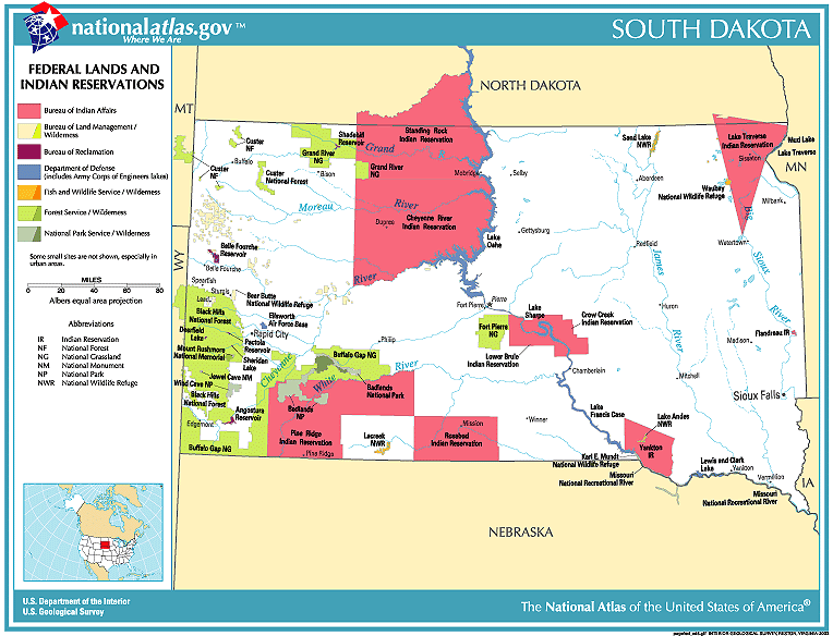
With seven Sioux Reservations spread across the state, about 8.5% of the South Dakota population is Native American. Anglos are the largest group, at 80.5%. Hispanics are 5.1%, Blacks 2.6%.
Sioux Falls in the state’s southeast, roughly where Minnesota, Iowa, and South Dakota meet, is South Dakota’s largest city, at 209,289. Rapid City in the Black Hills has a population of 79,894. There are no other South Dakota cities with populations greater than 50,000. Pierre, the state capitol, has a population of 13,788. Pierre isn’t on an interstate highway.
The Black Hills are South Dakota’s only mountains, and they’re an isolated range in the state’s far west.6 Tourism has replaced mining as the Black Hills’ principal industry, and towns like Deadwood, Custer, and Keystone are tourist destinations.
Badlands National Park, parts of which are in the Pine Ridge Reservation, is located south and west of the Black Hills. The badlands are the product of deposition of horizontal layers of soft sedimentary sandstones, siltstones, limestones, shale, and other stuff that are eroded by wind and water into magnificent layered displays of time. The oldest formations are from the Western Interior Seaway and date from 75-69 million years ago. The most recent formation includes a layer of volcanic ash from volcanoes in Utah and Nevada, and are 34-30 million years old.

South Dakota is divided roughly in half by the north-south Missouri River. The east of the state is plains: the Dissected Till Plans (which also covers parts of Iowa and Nebraska, and which is an excellent place to grow corn), the Couteau des Prairies (which also covers parts of Minnesota and Iowa and is an excellent place to grow corn), and the James River Basin which cuts eastern South Dakota north to south.
Other than the Black Hills, South Dakota west of the Missouri River is arid, and is part of the Great Plains.

In addition to the Missouri River, the James and the Big Sioux Rivers cut the eastern half of the state north-south and meet the Missouri at the Nebraska state line. The east-west Grand, Moreau, Cheyenne, Belle Fourche, Bad, and White Rivers are spaced fairly evenly through the western half of the state, and they also feed the Missouri. All of the state’s best-known trout streams, Rapid Creek, Castle Creek, and Spearfish Creek, are small, relatively isolated creeks fed from springs and runoff in the Black Hills.
Black Hills Fish
The Black Hills are not only geologically isolated, they are biologically isolated as well. During Custer’s expedition, William Ludlow, the chief engineer for the Corps of Engineers’ Department of the Dakotas (and an angler), declared that there were no more suitable streams for trout anywhere than those of the Black Hills. He also noted that, in fact, there were no trout. He was right on both counts. There were the important game species of chub, suckers, and dace,7 but no trout.
We have spread more trout to more places than any other species of fish. I can now fish for trout in Texas, Chile, New Zealand, and Costa Rica. I have fished for non-native trout in non-native habitat from Argentina to Utah, and have fished for non-native species of rainbow or brown or brook trout just about everywhere. We love to move the various species of trout around, and they often thrive with changes in scenery.8 By the 1880s we were introducing trout into the Black Hills.
The Black Hills trout streams are now managed with reproducing wild fish supplemented by stocking, but none of the trout are native.

Politics
All of South Dakota’s state officials, from Governor on down, are Republicans. Even Kristi Noem’s dog was a Republican, for all the good it did her.
South Dakota has only a single member of Congress,9 and he’s Republican. Both US Senators are Republican.
In the 2024 election, Donald Trump received 63.43% of the South Dakota vote. The \counties that didn’t vote for Trump were either Clay County, where the University of South Dakota is located, or majority Native American.

Kristi Noem’s Dog
The character of some places is forever shaded by a single moment: the Pilgrims landed at Plymouth Rock, David Crockett died at the Alamo, Charleston fired on Fort Sumter, North Dakota fracked . . . In South Dakota, Governor Kristi Noem shot her dog. Then she bragged about it.
If you have a German wirehaired pointer and it has messed up your pheasant hunt, you don’t have to shoot it. There is a national rescue just for GWPs. I don’t think Kristi Noem is on the board. For a good discussion of what went wrong with Kristi Noem’s dog, All Things Outdoors did a nice job.

- Lakota is one of two closely related Siouan language groups, Dakota and Lakota. The Dakota are further divided into the Eastern Dakota (the Santee) and the Western Dakota (the Yankton and the Yanktonai). The Lakota people are also known as the Teton Sioux. ↩︎
- Sarcasm. Geologists can be baffling unintelligible when they name things. I might bet that orogeny means the process by which mountains originate, but I wouldn’t give my odds at better than 50-50. ↩︎
- Mount Elbert, Colorado, 14,440 feet. ↩︎
- It’s often said that Nevada silver had paid for the Civil War, but banks far preferred a gold-based currency. The conversion from a silver/gold currency to a gold currency was also happening in the newly united Germany. Germany pretty much mirrored the US during the depression. ↩︎
- In United States v. Sioux Nation of Indians, 448 U.S. 371 (1980), the Supreme Court awarded the Lakota a $108 million judgment against the US for the uncompensated taking of the Black Hills. The Lakota refused to accept the judgment, wanting not compensation but return of the Black Hills. The damages were set aside in an interest bearing trust, and are now valued at close to two billion dollars. Seems like a lot, but I’d guess that buying the Black Hills would cost more. ↩︎
- There’s also a sliver of the Black Hills in Wyoming. ↩︎
- Sarcasm. Chub, suckers, and dace, whatever their excellent personalities and ability to dance well, are not considered important gamefish. ↩︎
- The only game animal we’ve moved around as much as trout may be the pheasant. Pheasant hunts in South Dakota may be common, but they ain’t natural. Pheasants originate in Asia. ↩︎
- There are currently seven states represented by a single congress member, Alaska, Delaware, Montana, North Dakota, South Dakota, Vermont, and Wyoming. ↩︎


