Georgia Packing List

Gear

For trout in North Georgia we took 5-weight rods with floating trout lines. We used long 9-foot 4X fluorocarbon leaders with weighted nymphs. I took an Abel disc drag reel, kinda the pinnacle of obsessively over-built trout reels, but it didn’t get much of a workout. For all the trout I caught I could have used a spool of bright yellow sewing thread, or kitchen twine, or bailing wire, with any of them tied to a stick I picked up on the riverbank. It would have been harder to cast, but I would have caught just as many fish.

In saltwater we fished with 8-weight rods and floating redfish lines, with 7-foot 16 lb leaders. We used the guide’s flies, which if you squinted real hard looked a bit like tarpon toads. They were prettier flies than what I use at home for redfish. My redfish flies look like deformed bits of cotton plucked straight from the boll and colored brown with a Magic Marker. I forgot to take a photo of the guide’s redfish flies.

We could have used the guides’ rods instead of hauling our own to Georgia, but how could we ever amortize their cost if we didn’t haul them with us? We gotta get our money’s worth.

Barbecue

I found a list of Georgia barbecue places on the internet, and on the way to Savannah we stopped at one. Because I didn’t particularly like the barbecue, I’m not going to mention it’s name. Just remember, it’s somewhere between Ellijay, Georgia, and Savannah. I’m sure there are better places than the one I chose, but Georgia being Southern I expected anything that made a list to be quality barbecue. This wasn’t bad, but it wasn’t good either. Maybe I’ll try again someday.

We did get a pretty good Cuban sandwich in Blue Ridge, but as a Texan I have strong barbecue opinions but am mostly ignorant about Cuban sandwiches. I thought it could have used some pickles, but what do I know?

Donuts

We stayed in the northside Atlanta suburbs for wedding festivities. Two mornings we ate Atlanta suburban donuts, once at a utilitarian donut shop next to a gas station, Marietta Donuts, and once at an artisanal donut shop, Doughnut Dollies. Both had good donuts, and Doughnut Dollies managed to walk that fine line between too much imagination on the one side and boredom on the other. That’s not easy to do when you’re hawking artisanal doughnuts. I especially liked the frosting on Doughnut Dollies’ strawberry and orange doughnuts. All that fruit made me feel healthy.

Restaurants

Ok, so the barbecue we tried wasn’t great, but we otherwise ate a lot of good food in Georgia. In eight days I gained eight pounds.

The first night we went to a Korean place, Woo Nam Jeong Stone Bowl House, on Atlanta’s Buford Highway. Atlanta seems mostly to be either Anglo (50.7% in the metro area) or black (32.4% in the metro area), but that’s mostly. There is a Hispanic and Asian population, and Buford Highway is this strange culinary accident where a lot of Asian and Hispanic mom and pop restaurants have landed. I could have gone back to that Korean place for every subsequent meal. The food was so elegant but at the same time so homey and delicious that it was impossible not to be happy. All those dishes of pickled stuff couldn’t have been more beautiful. And all the bowls matched, which is more than you can always say at our house.

I suspect I could eat for days on Buford Highway.

Lunch Saturday we ate at Mary Mac’s Tea Room. It’s an Atlanta meat-and-three African American institution that serves huge–and I mean really really huge–portions of Southern food. Covering the walls they had photos of famous people who’d eaten there. There were several of Jimmy Carter and, of all people, the 14th Dalai Lama. I guess the Dalai Lama knows a good meat-and-three when he sees it. They didn’t ask for my photo for the wall, but I suspect that’s only because I couldn’t clean my plate.

Sunday evening we ate at a Vegan Mexican/Cuban place, La Semilla. Vegan Mexican/Cuban seems to me a strange combination, more because of the Mexican/Cuban than the vegan, but it was completely successful and very hip. I’m sure some of that hipness rubbed off, and you’re now reaping the benefit. Our friend Shelley can’t eat dairy, and she declared the vegan queso the trip highlight, because queso.

In Savannah we ate at The Grey, which is one of Georgia’s best-known restaurants. They priced accordingly, but it was worth it. If nothing else, it’s located in the old Savannah Greyhound Bus station, and who can resist repurposed 1930s streamlined modern art deco architecture? We couldn’t decide what to eat, so we copped out and ordered the tasting menu. They also had the greatest cop-out martini ever, named for one of the owners who could never decide what she wanted. It was advertised as a mix of curated gins and vermouths, with both a twist of lemon and olives. It was the perfect martini for the indecisive, and could only have been improved if they’d both shaken and stirred it. It was excellent, and if I’d drunk two it would likely have been more excellenter. I only had one and I could still barely speak English.

We ate at Common Thread, which was also highly recommended, expensive, and excellent, and we got ice cream at Leopold’s because we were walking down the street and there was a line. Who can resist a line at an ice cream parlor, and if you can, why would you want to? There’s a lot of good food in Savannah. There’s a lot of good food in Georgia, though the jury’s out on the barbecue. Did I mention I gained eight pounds?

The Civil War

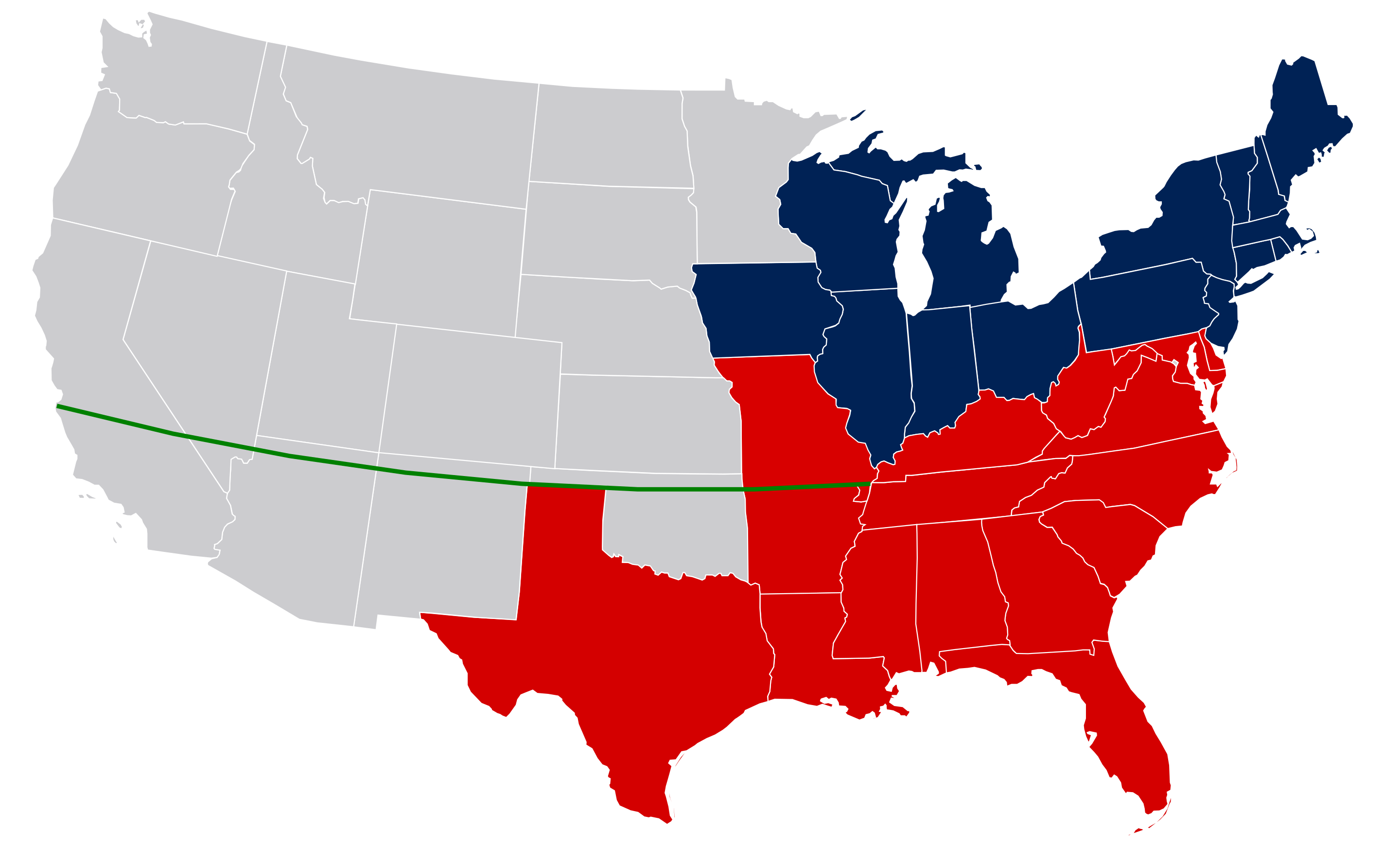
Georgia was the industrial heart of the Confederacy. From 1863 to War’s end, Georgia was the final focus of the Union’s Western campaign. After the Confederates under General Bragg defeated the Union under General Rosecrans at Chickamauga, Ulysses Grant took charge of the Western campaign. Grant changed the War. Under Grant, General Sherman led the Union in two of the most important campaigns of the War, the Battle of Atlanta and Sherman’s March to the Sea. I had three great-great grandfathers at Atlanta, two Confederate, one Union. Those Union victories cut off the Army of Northern Virginia, and with Grant’s Virginia campaign the War ended.

Chickamauga, September 18-20, 1863, was a major Union loss, and the War’s second bloodiest battle. There were more than 34,000 Union and Confederate casualties, and more than 4,000 deaths. That means that over three days, 34,000 Americans, Southern and Northern, were shot, stabbed, or blown up, and more than 4,000 of them died. The Union fought at Chickamauga to capture the Chattanooga railroad hub and open Georgia for Union invasion. The South fought to destroy the Union’s Army of the Cumberland. The South won the battle, but under Bragg they didn’t cripple the Union army. Because the South failed, two months later at Missionary Ridge Chattanooga fell to the Union under Grant. That defeat at Chattanooga may well have ended the South.

We visited the Chickamauga battlefield, and weirdly it’s in Marjorie Taylor Greene’s Congressional District. It’s odd that one small region could produce two such catastrophes.

Chickamauga National Battlefield. Apple Maps.

Back to Atlanta. In addition to wedding festivities and eating, we visited the Botanical Garden and the High Art Museum, but best of all we visited the strange Battle of Atlanta Cyclorama at the Atlanta History Center. The History Center has a solid presentation about the Battle of Atlanta, of which the Cyclorama is only a part, but the Cyclorama is its own attraction. It’s a 358′ x 49′ hand painted canvas, which is a painting longer than a football field. It may be the largest oil painting in the world.

Some interesting tidbits about the Cyclorama. According to the history center, Southern troops at the Battle of Atlanta outnumbered Northern, but the Cyclorama was painted in the 1880s in Ohio, a Union state. In the painting the South is vastly outnumbered. When the Cyclorama was first moved to Atlanta in 1891, many of the Union soldiers were repainted with grey uniforms to show the South winning the battle. It’s a problem with history. It’s hard not to slant the presentation.

Where We Stayed

In Atlanta we stayed in the Roswell DoubleTree. It was fine, but where we stayed was less important than that we were in the suburbs, and (except for the Atlanta Brave’s Truist Park), a lot of Atlanta eateries and attractions seem to be located centrally within easy driving range of downtown. Every time we went somewhere–well every time we went somewhere other than Total Wine, REI, or the wedding–we had to drive 20 miles. If I ever go back to Atlanta, I’ll stay somewhere central.

In North Georgia we stayed at a B&B, the Overlook Inn. If you’re going to some relatively remote mountain destination, you’re statutorily required to stay in a B&B. It was pretty, and on our second night we ate dinner there. Kris always complains about B&Bs because on the mornings we fish we never get to eat the breakfast, but she didn’t complain about this place, maybe because our friends the Marmons were there. And the dinner we ate there–all four of us had the smoked trout–was great. The Georgia mountain views were also great.

In Savannah we stayed at a restored 1960s motor lodge, The Thunderbird Inn. Who doesn’t like a restored 1960s motor lodge? This one had everything you could want except Magic Fingers, a swimming pool, and free parking. The turndown service was a Moon Pie and RC Cola, and there was 24-hour coffee and popcorn in the lobby. The rooms were small, the colors bright, and the sign was neon, so it was almost perfect in every way. It was also very central, but everything in Savannah seems reasonably central.

Where We Didn’t Go

When we fished in North Carolina we stayed with our friend Bryan, and his family had given him a week in Blue Ridge, Georgia, for his birthday. We went to Blue Ridge, and we had a good Cuban sandwich there, but Bryan didn’t go to Blue Ridge for the Cubano. Bryan went to Bill Oyster’s six-day bamboo rod building class. He hadn’t been yet when we stayed with them, but later he sent me pictures of the classes and the rod he built.

Now I can’t find Bryan’s pictures. They’re on my computer somewhere, probably under my virtual bed, or in a virtual drawer in my virtual closet. They were great photos, and I was jealous. Bryan made a beautiful rod.

Bill Oyster is famous for his rod-building class, and maybe more famous for his bamboo rods and his metal engraving. Bamboo rods aren’t explicable. They’re best compared to an old Jaguar E Type, or a 1956 Martin D-28, or a first edition of Absalom, Absalom. It may not be the most useful thing in the world, but it’s so . . . irreplaceable, beautiful, timeless . . .

One of Bill Oyster’s bamboo rods built for Jimmy Carter. Photo shamelessly cadged from OysterBamboo.com

And Bill Oyster makes some of the most beautiful bamboo rods in the world. He made two for Jimmy Carter, who was a serious fly fisher. They were gorgeous things, with gorgeous engraving. Oyster told a story to the American Fly Fishing Museum about how he made the first rod for President Carter, and how Carter was going to fish it a bit, sign it, and then it would be sold as a fundraiser for the Carter Presidential Library. Carter fished it a bit and then told the Library that they’d better buy another because he wasn’t giving back the first.

I remember talking to Kris after Bryan went to Blue Ridge, and she just didn’t get it. Why would somebody pay good money to build something, when for the same money they could buy a rod from a real builder? I’m still baffled by her response. Why wouldn’t you want to build your own bamboo rod? And also the prices aren’t the same. The rod class currently costs $2,950–and almost all the classes for 2024 are full. Oyster also has some fly rods listed for sale online, and an 8′ 5 weight lists for $5,760. The cheapest rod listed is a 8′ 9 weight saltwater rod for $3,320.

8 5-weight Bill Oyster Master, photo shamelessly cadged from OysterBamboo.com

Isn’t that rod-building class a bargain?

I don’t know though. That 8′ 5 weight looks pretty sweet. I might have to get a prettier reel though. And I might have to give up some stuff, like food.

Benedetto Guitars are made in Savannah, but I’m afraid they’re out of my league. I guess Oyster fly rods are also out of my league.

Playlist

Georgia had a great music playlist. Blind Willie McTell, Gnarls Barkley, Harry James, R.E.M., Cat Power, James Brown, Trisha Yearwood, Gladys Knight, Little Richard, Fletcher Henderson, Otis Redding, The Allman Brothers, The B-52s, Ma Rainey, Indigo Girls, Jessye Norman, Robert Shaw, Robert Cray, Kaki King . . .

There’s also Atlanta HipHop, plus there all those great songs about Georgia. I could listen to Rainy Night in Georgia once a day from here on out, and never get tired of it. There’s Georgia on My Mind, I Been to Georgia on a Fast Train, Midnight Train to Georgia, The Devil Went Down to Georgia, and if you get tired of those there’s Moon River and Skylark.

That playlist is good enough to keep me happy on a six-hour drive, through Georgia, on a rainy night.

Blind Willie McTell

Guitar

I took the Kohno and practiced some. I should have found a transcription of Moon River.

Georgia

Scarlett O’Hara’s Bosom and Early Georgia History, in Order of Personal Significance

I figured that if we were going to Georgia I should re-read Gone with the Wind. I hadn’t read it since I was 12, and when I was 12 I liked it, or at least I liked having read it. All that Southern splendor was mighty fine, plus there was that movie poster featuring Scarlett O’Hara’s bosom. What Southern almost-adolescent boy could ignore the drama inherent in Scarlett O’Hara’s bosom? I had a copy of that poster on my wall, and I suspect it was years before I noticed that Clark Gable had a moustache.

My notion before our trip was to determine whether Gone with the Wind was anything more than a Lost Cause romance. After all, no book except the Bible has sold more American copies than Gone with the Wind. It won the 1938 Pulitzer Prize, so somebody once thought it was important literature. The movie won the 1939 Oscar for best picture, and adjusted for inflation, it’s still the highest grossing movie ever.

I downloaded a free copy of the novel on Audible, but I couldn’t listen past the second chapter. What my 12-year old self admired, my 67-year old self found dreadful. Lost Cause propaganda? Who knows–I never got that far. These characters were all of them idiots. They were annoying and unlikeable and inane. Maybe Margaret Mitchell intended that they be annoying and unlikeable, but I don’t think they were supposed to be boring. I was unmoved by the set-up, despised the dialogue, and found Scarlett, cleavage or no, to be a ninny. I wanted to waste no more of my life with Mammy or the twins or Ashley or Melanie. I didn’t give a damn about Scarlett, or for that matter about Rhett.

So I can’t really tell you anything about Gone with the Wind, except I’d advise don’t bother. It had its moment, but that was when I was 12.

Still, that’s the best movie poster bosom ever. It’s Stereophonic.

I did read a good book about Georgia, Georgia, a Short History, by Christopher Meyers and David Williams, and there was some interesting stuff to learn.

Georgia was the youngest of the Thirteen Colonies, founded by James Oglethorpe in 1732 as a second chance for British debtors and a buffer against Spanish Florida. Settlers were from England’s poorest, and Oglethorpe prohibited hard liquor, slaves, and lawyers. Land was to be owned by the colony. Each immigrant’s tract was limited to 50 acres.

That bit of social engineering lasted roughly 20 years. There was no debt forgiveness, so not only were the English urban debtors–who had likely never farmed–expected to farm successfully on small tracts in difficult coastal soil, they were expected to repay their English debts from their unsuccessful farming. Many of the debtors skipped out to northern climes, leaving both Georgia and their debts. By the 1750s there was private ownership of large tracts–up to 500 acres–by slave owners. There were probably lawyers, too.

James Oglethorpe, glam rocker and failed reformer.

What was supposed to be an agrarian yeoman farmer utopia became a utopia for wealthy planters. Before the cotton gin, the planters–the large-tract slave-owning landowners–were confined to rice farms near the coast, but with cotton production Georgia became part of the Cotton Kingdom. The Trail of Tears and railroads opened upland Georgia to white settlement, and large landowners brought slaves and cotton to the upper Coastal Plain and the Piedmont to fill the void.

Georgia also achieved land fraud on a massive scale. After the Revolution, counties and the state sold land to new settlers and speculators, but they got into the habit of selling more land than there was actually dirt. The worst offender, Montgomery County, issued land warrants for 7,436,995 acres of land, which was 7,029,315 more acres of land than Montgomery County actually contained. By 1796, Georgia county officials had issued warrants for 29 million acres. Georgia then contained only 9 million acres.

The State Assembly was good at land sales, too, and in exchange for bribes (which in addition to money included nifty stuff like land, guns, and slaves) sold 50 million acres of Indian land for about a penny an acre–a ridiculous price for land that they had no right to sell. The sales were rescinded by the next Assembly, but were then found valid by the Supreme Court under the Contract Clause. The U.S. Congress ended up buying out the purchasers for $4.25 million. No Georgian should ever complain about federal buy-outs. Their’s was one of the first, and in inflation-adjusted dollars probably rivals anything that came later.

No state’s early American history was as governed by class hierarchy as Georgia’s, and how you see Georgia’s early history really does depend on where you stand. If you look at Georgia from the planters’ eyes, by the 1850s it was an economic dynamo powering a thriving economy. In 1860 Georgia’s per capita wealth was nearly double that of New York, which is pretty impressive, but on the other hand only six percent of white Georgians controlled about half the state’s wealth, which is pretty one-sided.

A lot of plain white folk saw Georgia differently from the planter class, particularly in the northern mountain portion of the state where there were few slaves, and in the southern Pine Barrens which couldn’t support big agriculture. In Georgia cities, slaves devalued free labor, and other than the rice and cotton planters, Georgia agriculture was largely small-parcel subsistence farming. In 1860, Georgia’s slaves were valued at about $400 million, about half the state’s wealth, but only about 37% of the white population owned any slaves, and planters were a sliver of that 37%.

Carrying Cotton to the Gin, Harper’s New Monthly, March, 1854.

And Georgia slaves like as not saw Georgia differently from their owners. When Georgians voted to secede and join the Confederacy, the measure passed by about 1000 votes, 42,744 to 41,717–but remember, these voters could only be white male property-owners. Slaves, who were 44% of the roughly one million Georgians, had no votes, and while one can never be certain, I’d bet good money that the slaves would have voted en masse to stay in the Union. Lincoln may not have planned to free the slaves, but apparently slaves throughout the South were convinced–along with the secessionists–that freedom was Lincoln’s plan.

Among plain white Georgians, the Civil War was increasingly seen as a rich man’s war fought by poor men, and throughout the war there were large numbers of deserters, draft dodgers, and even Union volunteers. In Georgia there were food riots, draft rebellions, and the formation of an active and vocal Peace Society. The cotton class may have seen the War as necessary and righteous, but to support the war effort they kept planting cotton instead of corn, hence the food riots. Wealthy planters were largely exempt from the draft and generally weren’t doing the actual fighting. Whatever else can be said about the South, the Confederacy was badly managed on the home front. By the end of the War, it’s estimated that nearly half of the Confederate army had deserted.

18,250 Georgian Confederates died in the Civil war, roughly a fifth of those who served. Georgia was also a battlefield from Chickamauga in 1863 in northwest Georgia to Sherman’s March to the Sea.

Georgia Geography

Pamela W. Gore, Geographic Regions of Georgia, from the New Georgia Encyclopedia.

By area, Georgia is the largest state east of the Mississippi, and 24th overall. It divides into five geographic regions. The Coastal Plain is in the south, and the southeastern border of the Coastal Plain is the Atlantic Ocean. The Piedmont is north of the Coastal Plain, above the fall line where rivers tend to rapids and the sedimentary rock of the Coastal Plain gives way to the harder crystalline rocks of the uplands. Generally the Piedmont soils are richer than the soils of the Coastal Plain, and Georgia’s southern Coastal Plain, the Wiregrass Region, is one of Georgia’s poorest regions. The exception for richer Coastal Plain soils is the rich black soil immediately below the Piedmont, the Black Belt that stretches from Georgia through Alabama to the Mississippi Delta. Along with the Delta became the Black Belt became the cotton-producing heartland for the South. The Black Belt was named first for the color of its soil, but the identification took on a new meaning because of the concentration of slaves. Big cotton thrived on black soil and slavery.

Abbasi786786, Majority Black Counties Based on the 2020 Census, from Wikipedia.

In Georgia’s far north, the three remaining regions seem to this outsider divided by terrain but otherwise lumped together, and it’s in North Georgia where Appalachia begins. The Appalachian trail starts northward in North Georgia, from Springer Mountain, elevation 3,780 feet, and James Dickey set Deliverance on a made-up river in North Georgia. We will trout fish in North Georgia, somewhat close to Brasstown Bald, Georgia’s highest mountain at 4,784 feet. I’ll take a guitar in case we run into any banjo players, but I’ll be damned if I do any canoeing.

Georgia is water rich. It has 14 major river basins, with more than 44,000 miles of perennial rivers. Its rivers tend to have great names: the Suwanee, the Ocmulgee, the Coosa, the Llappoosa, the Chattahoochee . . . Plus Georgia has about 100 miles of Atlantic coastline. The combination of elevation, coast, and rivers makes Georgia rich fishing. In the north there are native Appalachian brook trout and imported brown and rainbow trout. There are imported stripers in lakes, and redfish along the coast. There are ten species of black bass, including great river bass like the redeye, and bass unique to Georgia like Bartram’s.

We’re going trout fishing instead of bass fishing because we’re going to Atlanta for a wedding, and our friend Shelley (who will also be at the wedding) likes to fish for trout. Still, there’s always a chance of catching a bass in those northern Georgia rivers. I hope I catch a bass. Well, come to think of it, I hope I catch anything at all.

Population

At 21,029,227, Georgia is the 8th largest state by population, bracketed by Ohio at number 7 and North Carolina at number 9. It is one of the fastest growing states since World War II, and us Houstonians see Atlanta as our Southern mirror. Anglos are 50.4% of the Georgia population, African Americans 33.1%, and Hispanics 10.5%. Everybody else is a smidgeon. Most of the population growth is in Georgia’s Piedmont, which is the industrial heart of the state.

Other than the whole slavery thing, the birth of the modern Ku Klux Klan, and Jim Crow segregation, Georgia’s civil rights history had some positives. Martin Luther King Jr. was a pastor at Ebenezer Baptist Church in Atlanta, and Georgians were leaders in the Civil Rights movement throughout the South. Savannah desegregated early, but despite active movements Albany and Atlanta were slow. In 1971, then-governor Jimmy Carter declared a new era of Civil Rights in Georgia, but particularly in the rural areas of the state Jimmy probably jumped the gun.

Valdosta, Georgia Klan Rally, 1922, Georgia State Archives.

Politics

Is any state’s recent presidential politics more interesting than Georgia’s? I don’t pretend to understand what happened in 2020, but I have no doubt that there was no theft of the Georgia election. I’ve officiated over local elections, and massive voter fraud would not be easy. Oh sure, some lone soul might vote twice, or not be registered, but everything in American elections makes massive fraud almost impossible. It certainly couldn’t be accomplished by the efforts of a handful of people. It would take a whole dance card of conspiracy, and people, being what they are, would never be able to hide it. They can’t keep their mouth shut. If there had been massive fraud in Georgia, somebody involved would have bragged about their part over beers, at Thanksgiving dinner, or in their tell-all best seller. Instead as evidence of election interference we have a phone recording of a sitting President urging a governor to manufacture votes.

When you look at how the actual vote went, Georgia’s voting patterns are just like the rest of the country. Urban areas voted Democratic, and outside of the Black Belt, the rural countryside voted Republican. Trump substantially increased his vote totals from 2016, 2,089,104 votes in 2016 to 2,461,854 in 2020, but the Democrats did even better, 1,877,963 to 2,473,633. Democrats mostly carried majorities in the urban areas (as they had in 2016), but more total voters in rural areas also voted Democratic. F’rinstance, Atlanta’s urban Fulton County turned out substantially more Democratic voters in 2020 than in 2016 (529,931 to 334,053), but that trend was true in every Georgia County, even in counties where Trump otherwise had a majority. In the numerous rural counties Donald Trump carried, his margins shrank. Throughout the state voters who would not turn out in 2016 to vote for Hillary Clinton turned out in 2020 to vote for Joe Biden, or maybe to vote against Donald Trump.

From Wikipedia, AdamG2016, Georgia Presidential Election Results 2020.

Where We’ll Fish

Our plan doesn’t involve voting. We’ll fly into Atlanta and do wedding things for three days, then drive north with our friends the Marmons to Ellijay to fish a half day for trout. We’re taking waders and boots and 5-weights. The next day the Marmons head back to Houston, and Kris and I will head south out of Georgia’s Valley and Ridge, through the Piedmont, down to Savannah on the Coastal Plain to fish in saltwater for redfish. I may not catch any fish, but I will see a lot of Georgia. We fly back to Houston from Savannah.

Missouri

On Monday we decided that on Friday we’d drive to Missouri, to Branson. That’s a short turnaround, but I’ve been to Missouri plenty. My Grandmother Eva–not that Grandmother Eva, the other Grandmother Eva–was born in Missouri, in Osgood near the Iowa border, in 1890. When I was five or six, circa 1963, we took her home from Texas to see her siblings. We stayed with one of her sisters, and while the house may have had electricity, it didn’t have indoor plumbing. There was a pump in the yard for water and an outhouse for other sundry stuff. It was on a gravel country road, and at night I saw fireflies for the first time. It was wonderful.

I’ve been to Missouri some since, enough to know that Kauffman Stadium in Kansas City is as pretty as MLB stadiums get (though I don’t recommend it in August), and that the riverfront town of Hannibal has seen better days. I’ve been to Missouri enough to know that while any Texan would tell you that Missouri barbecue is mediocre stuff, the sandwiches at Gioia’s Deli on The Hill are worth the effort. On The Hill you can still imagine Joe Garagiola and Yogi Berra as children in the neighborhood’s heyday. Not so much Mark Twain and Hannibal.

Kauffman Stadium, Kansas City, 2015.

There are good fishing rivers in the Missouri Ozarks, and if we were being intellectually honest we would target native Missouri smallmouth, but we haven’t fished for trout in a while, and there are plenty of Missouri rivers stocked at one time or another with trout. In Branson there is the Ozarks’ White River at the Taneycomo Lake dam. One Missouri spring creek near Branson, Crane Creek, claims the purest strain of McCloud River redband trout in the world. They were stocked in the 1880s from eggs imported from California and supposedly dumped off a bridge by railroaders.

Records are a bit sketchy, but Crane Creek has been stocked no more recently than the 1920s. Because it was the site of the second national fish hatchery, the McCloud River redband was the original source of most of the stocked rainbow in the world. Only in Crane Creek does the original strain remain unmixed with other rainbow subspecies.

By all reports the Crane Creek trout are small, skittish, and hard to catch. The stream is narrow and overgrown, and there’s poison ivy and water moccasins. Of course that last is likely overblown, and there are more likely a lot of non-venomous northern water snakes and maybe some moccasins. It is a herpetologist’s truism that everybody thinks that every water snake is a vicious, vindictive, or aggressive cottonmouth, but they aren’t more vicious, vindictive, and aggressive than most of us, and most of the snakes you see in the water aren’t moccasins.

Anyway, it sounds like we have to fish Crane Creek.

I’ve been looking at Missouri rivers for a while, thinking we would avoid Branson. We could do it, but Branson is convenient. It’s a strange place, a tourist destination that is a distant cousin to Nashville. It is a vacation destination for devout Southern and Midwestern protestants, seemingly devoted to clean living, family entertainment, golf, lakeside condos, and fatty foods. There is fishing though, and a good fly shop. It’s about a 10-hour drive from Houston. We can take the dogs, and coming home we can spend the night in Bentonville, Arkansas. Branson eateries tend towards family entertainment and national chains. Bentonville, as the business hub of Walmart, has better places to eat.

A short note on pronunciation

Apparently there’s no correct pronunciation of Missouri. The most common pronunciations are either Missour-ee or Missour-uh, but neither is incorrect, and they aren’t even the only ones. I grew up with Missour-uh, and long assumed that since I had some Missour-uh ancestry my pronunciation must be correct, but no. Still, it’s not wrong either. Oddly, how you say Missouri isn’t governed by education, wealth, race, or even geography. It’s not a South versus Midwest thing. It’s just the luck of the draw or maybe personal taste. Some Missourans say Missour-uh, some Missour-ee, and some go back and forth between them. All things should be so accommodating.

The Missouri Compromise

The U.S. acquired Missouri in 1803 as part of the Louisiana Purchase, and St. Louis became the jumping-off point for a big part of western expansion. In 1821 it became a state under the Missouri Compromise: to maintain political balance, Maine entered the Union as a Free State, while Missouri entered as a Slave State. After the admission of Missouri, no new territory north of the 36°30′ parallel could enter the Union as a slave state.

undefined

Julio Reis, Map of the United States c. 1849 (modern state borders), with the parallel 36°30′ north, Wikipedia, 2009.

The state lines in the map above are mostly modern boundaries. West Virginia wouldn’t exist until the Civil War. None of the grey states existed, except California. It’s the green line, the extension of the Mason-Dixon Line along 36°30′ that purportedly controlled American expansion for the next 30 years. See that far north border of Texas, and the Oklahoma Panhandle? The Oklahoma Panhandle was originally claimed by Texas, but when Texas entered the Union in 1845, that northern bit was above the line. To preserve the Missouri Compromise, it was cut off and left as part of the Indian Territory.

After the Missouri Compromise, there was a push among Southern slaveholding states to annex Cuba as a Slave State, to maintain Southern legislative power. It wasn’t going to happen. Cuba was valuable to Spain, and there was no real interest in annexation among most Cubans, but it’s amusing to guess whether Governor Fidel would have been a Republican or a Democrat.

The Missouri Compromise lasted until the Kansas-Nebraska Act of 1854 provided that Kansas and Nebraska would enter the Union as slave or free based on the votes of Kansas or Nebraska settlers. The seemingly sensible resolution threw the now-raging national slave debate into armed war. Abolitionists came to Kansas from the north, and pro-slavery Border Ruffians raided into Kansas from Missouri, and all of them brought convictions, guns, and knives. John Brown got his bones in Bloody Kansas. Kansas finally voted to enter the Union as a free state, but allowing popular local vote to determine only made the Civil War inevitable.

In 1857, in the Dred Scott decision, the Supreme Court determined that African Americans could not be citizens, that the federal government could not prohibit slavery in its territories, and for good measure that the already superseded Missouri Compromise was unconstitutional.

Reynolds's Political Map of the United States 1856.jpg

New York: Wm. C. Reynolds and J. C. Jones – “Reynolds’s Political Map of the United States” (1856) from the Library of Congress Geography and Map Division.

Population and Demographics

In 1820, the 66,586 population of Missouri was .6% of the nation’s total population. By 1920, Missouri’s 3,404,055 population was a biggly 3% of the total. St. Louis was the 6th largest city in the U.S., and had two major league baseball teams, the Cardinals and the Browns (now the Baltimore Orioles). Kansas City was 19th. By 2020, the St. Louis metropolitan statistical area, with a population of 2,820,253, was ranked 21st. Kansas City, with 2,192,035, was 31st.

In 2020, the total Missouri population of 6,154,913 was .1% of the total U.S. population of 329.5 million. It had gone from .6% in 1820, to 3% in 1920, to .1% in 1920. Missouri still had two major league baseball teams, though one was now the Kansas City Royals. The Kansas City Chiefs won the Super Bowl in 2020. They won again this year.

Missouri’s national importance was driven in part by Mississippi River trade and Westward Expansion, and with the decline of both, the its national importance also declined. Still, Missouri is where the South and the Midwest meet, in the same way that Texas is where the South and the Southwest meet. It is a black/white population, with heavy emphasis on white. Approximately 82% of Missourians are white, with less than 5% of that population Hispanic.

About 12% of the Missouri population is black, mostly centered in St. Louis and Kansas City, and in a stretch of southeastern counties along the Mississippi River, an apparent extension of the Arkansas and Mississippi Deltas. That delta population is likely a remnant of slavery, and the population growth in St. Louis and Kansas City was fueled by the Great Migration, both from the South and from less populated areas in Missouri. Hannibal, for instance was 14.5% black in 1900, but only 6.1% by 2020. Conversely, St. Louis was 6.1% black in 1900, but by 2020 the greater St Louis area was 17% black.

Satchel Paige, Untitled Photo, between 1935 and 1942, Library of Congress Prints and Photographs Division, Washington, D.C.

It’s worth noting that Kansas City became an African American cultural Mecca, being, along with New Orleans, Chicago, and New York, a major jazz hub. Count Basie was from Kansas City. So was Dexter Gordon, Lester Young, Big Joe Turner, Count Basie, and Charlie Parker. It was also the home of the Kansas City Monarchs, perhaps one of the greatest baseball conglomerations ever. Jackie Robinson jumped from the Monarchs to the Brooklyn Dodgers. Satchel Paige played for the Monarchs, and so did Cool Papa Bell, Turkey Stearns, Wilbur Rogan, and Buck O’Neil.

Lester Young by Ojon Mili. Time Inc. – Life magazine, Volume 17, Number 13 (page 40), Public Domain, https://commons.wikimedia.org/w/index.php?curid=44359804

The American Jazz Museum and the Negro Leagues Baseball Museum are at 18th and Vine in Kansas City, and are worth a special trip. And did I mention that Kauffman Stadium is one of the finest stadiums in Major League Baseball? It’s just too bad that Kansas City Barbecue isn’t better.

Of course Mark Twain is from Missouri, and T.S. Eliot, and Maya Angelou.

Politics

Both U.S. Senators from Missouri and four of the six Representatives are Republican. All of the six statewide elected officials, governor, lieutenant governor, secretary of state, auditor, treasurer, and attorney general, are Republican, and there are sizable Republican majorities in the state senate and house of representatives.

In 2020, Donald Trump carried the state by 56.80% of the vote, compared to Joe Biden’s 41.41%. Biden carried only Boone, Jackson, and St. Louis Counties. Jackson is Kansas City, St. Louis is, well, St. Louis, and Boone, in the middle of the state, is Columbia, home of the University of Missouri. Like other states, less-populated areas vote Republican, urban centers and college towns vote Democratic.

2020 presidential election, Missouri, By KyleReese64 – Own work, CC BY-SA 4.0, https://commons.wikimedia.org/w/index.php?curid=95975673

Geography

Missouri is divided into three major geographic regions, the Ozark Highlands, the Northern Plains, and the Coastal Alluvial Plain. No mysteries here. The Northern Plains are rolling, and you can grow corn and soybeans, soybeans and corn, and corn. There are lots of streams. It’s Iowa just a wee bit south of Iowa.

The smallest region, the southeast Coastal Alluvial Plain, is an extension of the Arkansas Delta, which is just like the Mississippi Delta but west of the Mississippi. It’s flat, wet, and a good place to grow rice, and cotton. Of course cotton.

The Ozarks are the Ozarks. They extend into Arkansas, Kansas, and Oklahoma. It’s a dome, cut into topography by erosion, faults, bluffs, rivers, and streams. It’s beautiful, dramatic country.

On the state’s eastern border there’s the Mississippi River. Cutting across the center of the state, roughly along the line that divides the Plains and the Ozarks, is the Missouri River. The Missouri meets the Mississippi at St. Louis.

Mark Twain’s Confederate Service

Mark Twain served as a Confederate militia lieutenant in Missouri, and he deserted after two weeks. Twain scholars have suggested that his desertion didn’t evidence opposition to the Confederacy, as much as concern as to the likely outcome of militia service in what was substantially Union-controlled territory. It’s pretty likely that Twain was dedicated to the South, and that his later reevaluation of the South and its cause was a principal source of his satirical brilliance. It’s hard to imagine Huck Finn written by someone who didn’t distrust most people’s pronouncements, including from time to time his own.

Osgood, Missouri, 2021.

A Texas Whatever in Connecticut’s Court

The best known writer from Connecticut, Hank Morgan, was a travel writer, and a good one, or at least a fun one to read. It doesn’t get edgier than when his strong Yankee character clashes with the customs and peculiarities of England. No writer is as arrogantly certain of his own superiority as Morgan, but that’s part of his virtue, and his descriptions are completely trustworthy. He has other shortcomings: I’m still not clear how Morgan got from Connecticut to England.

I’ve been to Connecticut once before, to poke around New Haven, which is best known for its pizza. I didn’t have any, not knowing then what I know now.

This time we’ll be in northwest Connecticut, on the Housatonic River. How do you say that? House-a-tonic? Whose-a-tonic? I don’t know, though even I know that it’s not Conn-ec-ti-cut, but isn’t that “c” dandy to pronounce? Who doesn’t like to? Connect. Connect. Conne-c-ti-cut.

Daniel Beard, Travel Writer Hank Morgan Up a Tree, 1889, Charles L. Webster & Co., New York, New York.

Connect-i-cuters don’t really have a very useful appellation. Nothing rolls off the tongue; not Connecticucator, Connecticutensian, Connecticutan. . . According to Webster (who was from New Haven), Connecticuter is correct, but I figure if I told somebody they were a Connecticuter, I’d have made an enemy for life.

Connecticut Yankees are also known as Nutmeggers, presumably because of the state’s vast fields of native nutmeg.

Demographics and Geography

Connecticut is the third smallest state, with 4,845 square miles. It’s smaller than Hawaii (with 6,423 square miles), but more than four times larger than Rhode Island (1,034 square miles). For all of that paucity of space, it is heavily populated, with 745 people per square mile. Compare that to Wyoming, with 55 people per square mile. In order of density, the states are New Jersey (1,263), Rhode Island (1061), Massachusetts (901), and then, crowding in at fourth, Connecticut.

Jim Irwin, Connecticut population density, English Wikipedia.

Population in the state isn’t uniformly distributed. It concentrates along the coast and the Delaware River. Hartford, for instance, population 123,000, has a population density of 7,091 people per square mile.

Connecticut has eight counties, but apparently no county governments, which seems odd given that politicians abhore a vacuum. There is the state, and there are towns. There’s other stuff, but state and towns without the bother of counties seems a notable effort at efficiency. In addition to the towns and the state, Connecticut has more than 300 special taxing districts and school districts, so I guess minimizing counties really doesn’t clear out much space government-wise.

The Connecticut counties that apparently don’t do much.

Connecticut is the southern-most New England state, which may seem obvious to most, but to those of us less familiar with the Northeast that’s a revelation. If you asked me most days what states comprise New England, I’d like as not throw in anything northeast of Missouri. Why, for instance, is New Jersey not New England, but Vermont, which was a relative late-comer, included in New England? It’s a mystery, probably tied to Beacon Hill snobbery.

With a population of 3,605,944 based on the 2020 census, Connecticut has a lot of white people, 80%, a surprising number of Hispanics, 17%, and is about 12% African American. Everybody else surely fits in somewhere, but not in any big numbers. It’s a rich state, 6th in median household income at $79,855. More than 90% of its adults have at least a high school degree, and 40% have at least a bachelors degree.

File:Map-USA-New England01.png
The New England States, WikiTravel. As you can see, New England doesn’t include either Ohio or Oregon or Oklahoma.

Compare that to West Virginia, just down the map, which is 92% white and only 1.7% Hispanic. About 88% of the of West Virginia adults have a high school degree, but only 21% of adults have a bachelors degree or higher, and the median annual income is $48,037. Wealth begets wealth.

Connecticut isn’t actually on the Atlantic Coast, but on Long Island Sound, sheltered from the Atlantic by the long Long Island peninsula. See United States v. Maine, 469 U.S. 504 (1985) (determining that Long Island is not, in fact, an island, but leaving open the question of length). A coastal plain extends west-east along Long Island Sound, and a river valley that follows the Connecticut River north-south smack dab through the center of the state. At 400 miles the Connecticut is the longest river in the Northeast, and we’ve happily fished it for trout and pike in New Hampshire, almost to Canada. The coastal plain and the river valley are the population centers.

The seashore is at sea level, and the average elevation in Connecticut is 500 feet. The highest point in Connecticut is the south slope of Mount Frisell on the Massachusetts border at 2,379 feet. The peak of Mount Frisell, 2,454 feet, is in Massachusetts. Mount Frisell is part of the Taconic Range, that is part of the Appalachians.

The remainder of the state is north-south hills and valleys created by plate tectonics, almost reminding one (if one is so inclined) of the Nevada basin and range system. Tectonic plates took land that measured more than 500 miles across (with estimates up to 3000 miles across), and scrunched it into 100 miles. I’m pretty certain that the technical geologic term for the cause of all those ups and downs is scrunching.

Its lakes, the Connecticut River Valley, the seashore, and its streams and riverswere formed by glaciers, the same Wisconsinite Glaciers that formed the Great Lakes about 10,000+ years ago. Wisconsinite Glaciers did’t do things in moderation. They dumped about 10 feet of junk over the hills of New England, and glacial drift covers about 99% of Connecticut bedrock.

Settlement, History

Massachusetts Puritans psuedopodded into the Hartford area in 1636. There followed various Puritan settlements, which were finally combined into a colony by royal charter in 1662. Connecticut later repaid the King’s generosity by joining in the American Revolution. The first major New England Indian/Colonial war, the Pequot War, centered in Massachusetts and Connecticut from 1636-38. The Pequots were actually interlopers themselves, and the Naragansetts and Mohegans joined with the English to drive out the Pequots. The Pequots lost, but then so ultimately did the Naragansets and Mohegans.

Pequot prisoners were exchanged in the West Indies for African slaves, so black slavery has an early start in Connecticut, and slavery was not ended until 1848. As of 1790, there were 2,764 slaves in Connecticut, out of a total population of 237,946. By 1830, the total population of Connecticut was 297,675, but the slave population had decreased to 25.

Into the 20th century, Connecticut was a leader in seafaring and ship building. During the Civil War, Connecticut was a manufacturing center for the Union, and the defense industry remains one of its important crops. Also insurance. Don’t forget insurance. Connecticut produced two famous insurance agents, Wallace Stevens and Charles Ives.

Connecticut also produced two presidents, George H.W. Bush and George W. Bush.

Hank Morgan typified the 19th century Yankee from Connecticut: industrious, capable, innovative, maybe a bit too sure of his virtue, but something in the national perception of the Connecticuter changed by the late 20th century. Connecticut became in the popular mind a New York bedroom community. Think of films from Connecticut, with their dark undercurrent of suburban angst: The Swimmer, The Stepford Wives, The Gilmore Girls . . .

I’ve watched The Gilmore Girls. It’s creepy that anyone can talk that much.

Politics

Connecticut is a Democratic state, with about 50% of its population Democratic or leaning Democratic. That’s consistent with the trends of urban areas and wealthier states tending to vote Democratic. All of Connecticut’s major state offices are held by Democrats, along with both US Senators and its five Representatives. There are some Republicans in the state assembly, 12 of the 36 senators and 54 of the 151 Representatives.

In 2016 Connecticut voted 54.57% for Hillary Clinton, with two counties, Litchfield (where we’re going) and Windham voting 54% and 50% respectively for Donald Trump. In 2020, Joe Biden carried 59% of the state’s votes; Donald Trump again carried Litchfield and Windham by 51%.

Tyler Klutsbach, 2020 Connecticut presidential voting, for Wikipedia.

Rivers and Fish

Fly fishing in Connecticut is all about trout. Connecticut would have been a brook trout state, but stocking programs favor rainbows and browns. I’m sure along the coast there are fly anglers who fly fish in saltwater, but search online and most of what you see is trout. Like a lot of stuff in Connecticut, I figure its angling is heavily subsidized with folk from New York City.

The big river through Connecticut is the Connecticut, which seems appropriate. As mentioned, we’ve fished for trout in the Connecticut River, but we fished way north, long before the Connecticut leaves New Hampshire. By the time the river reaches Connecticut it’s too warm for trout.

The best known trout river in Connecticut is the Farmington, which, including its West Branch, is 80 miles long, and which is part of the Connecticut River Basin. We’re not fishing the Farmington. No reason, but there you are.

Karl Musser, Housatonic River watershed, for Wikipedia.

We’re fishing the Housatonic (HOOS-ə-TON-ik), which runs 149 miles and drains a chunk of Western Connecticut and Massachusetts into Long Island Sound. It’s also a trout river, at least in the northwest portion of the state where we’ll fish. We’ll fish in Litchfield County, where 51% of the fish voted for Donald Trump in 2020. I figure it was the brown trout. Brown trout always seemed to me to tend Republican.

A Democratic rainbow